|
This is the procedure for creating cuts at all latitudes at a single longitude---one "region" per cut---with the IDL program
CUTTER_LON.
The value of this method is that the resulting set of cuts includes a representative fraction of all colors visible at the chosen longitude. Also, it is fair to assume that each cut has just one cloud structure. The problem is that only one viewing geometry is used, which provides little constraint for modeling that structure.
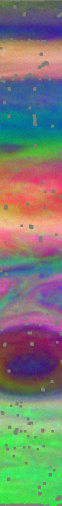
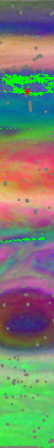
An area of the spectral image cube is selected from the F410M image. PCA is then performed on this area. The false-color image (center) shows the first 3 PCs (Red = PC1, Green = PC2, Blue = PC3). A true-color image shows that a large range of observed colors (I/F spectra) are present. Gray pixels in the PCA image (black in true-color image) are masked due to cosmic rays or bad pixels.
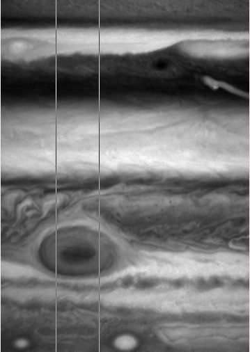
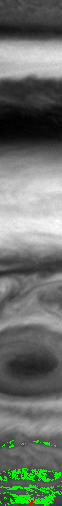
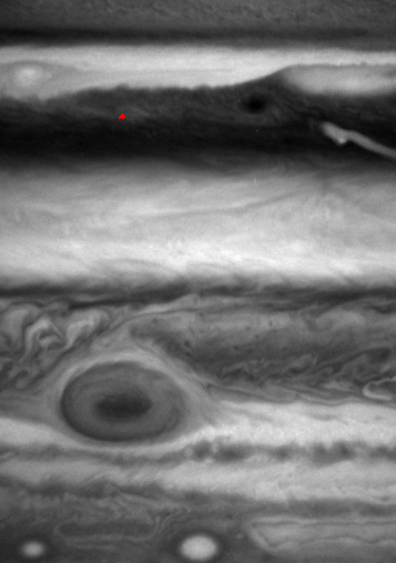
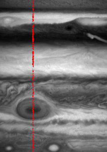
Fiducial points for cuts are taken at equal intervals in latitude at one longitude. Starting at the bottom and moving up, a fiducial point (red asterisk) is automatically selected from the center longitude. Spectrally similar locations (green pixels) are found based on the PCA results (see SEL_PCA). Fiducial points that fall on masked pixels or result in a cut containing fewer than 3 pixels are skipped. The GIF animation (right) shows the spectrally similar locations for all cuts at this longitude. A finer scan in latitude can be viewed here.
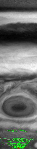
The final cut (red pixels) consists of locations that are both spectrally similar and within ± 0.0025 in μ and μ0 for each image in the cube.
In this example, 98 data cuts were successfully obtained for modeling from 100 fiducial points.
|
